TerraFed
Privacy-preserving federated learning and GeoAI for collaborative soil mapping, carbon and texture monitoring, and dashboard-ready outputs.
TerraFed
Privacy-Preserving Software Development
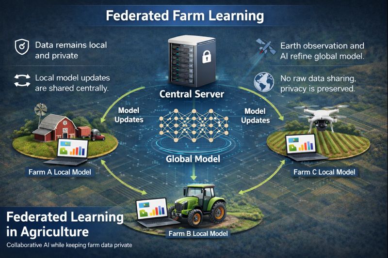
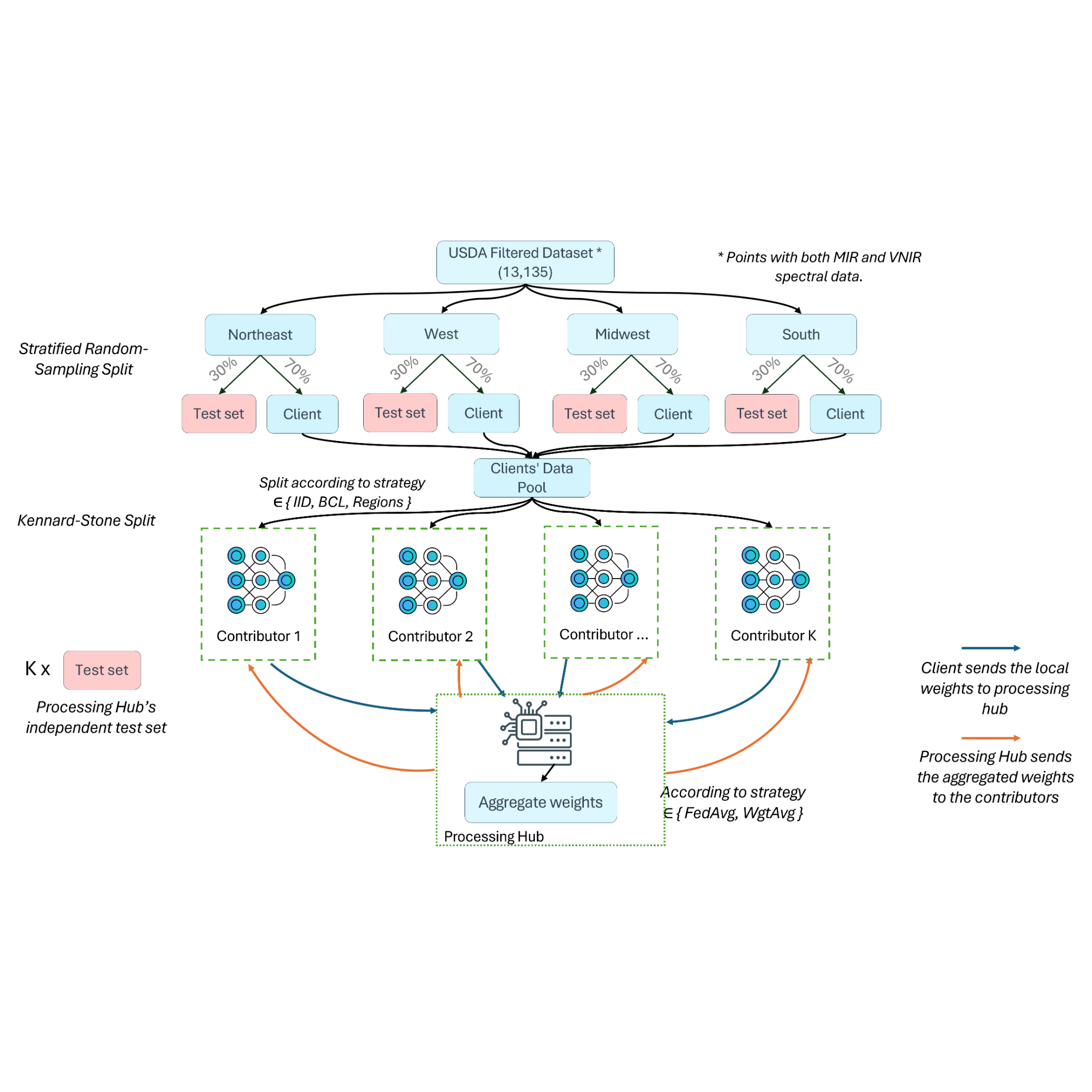
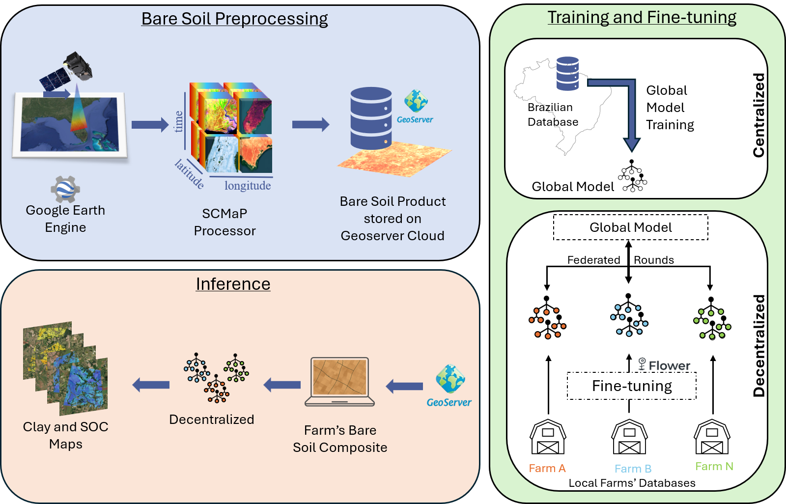
TerraFed is a research-to-application workflow for collaborative soil mapping across farms and institutions. It combines local soil observations, spectroscopy, and Earth observation covariates while using privacy-preserving federated learning and GeoAI to support carbon and texture monitoring without transferring raw datasets.
Built around real data-ownership constraints in agriculture, the workflow allows farms or partner institutions to train local models and share only model updates for aggregation.
Each client trains on local soil and environmental data. The central process aggregates model updates to improve a shared model while preserving local control of raw datasets.
Inputs may include local soil measurements, spectral information, Sentinel-2 style bare-soil composites, and geospatial covariates. Outputs can support clay, texture, and soil organic carbon monitoring, field-level interpretation, and dashboard integration.
Designed as a bridge between research models and operational decision-support systems, with exportable maps, reproducible reports, and workflows that can be adapted to new collaborators.
Key Features
- Federated model training without raw data pooling
- Integration of soil observations, spectroscopy, and EO covariates
- Farm/field-scale clay and SOC prediction workflows
- Dashboard-ready outputs for stakeholder interpretation