ServicesService details
GeoAI & Earth Observation Modeling
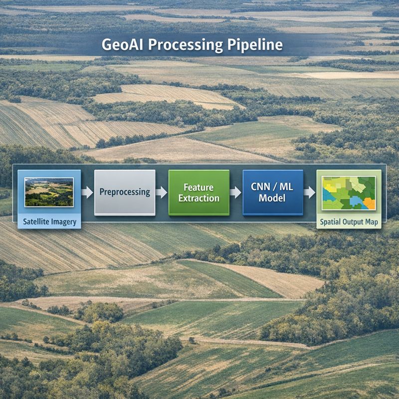
Designed for teams that need more than a map: I help structure the full workflow from AOI definition and Earth observation covariate extraction to model benchmarking, validation, uncertainty summaries, and dashboard-ready outputs.
Overview
I help teams convert Earth observation, soil, and field datasets into reproducible GeoAI workflows with defensible spatial outputs. The emphasis is on transparent covariate design, validation, error diagnostics, and products that can be reused in reports, GIS, or dashboards.
Ideal collaborators
Research labs, public agencies, NGOs, and climate/ag-tech teams working on agriculture, soils, water, and environmental monitoring where spatial products need to connect field measurements with Earth observation covariates.
What you get
- AOI definition, data inventory, and Earth observation covariate strategy
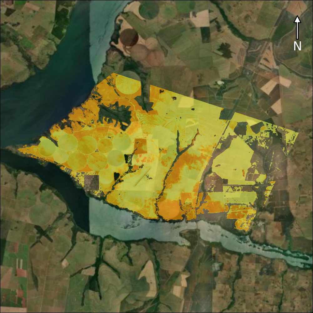
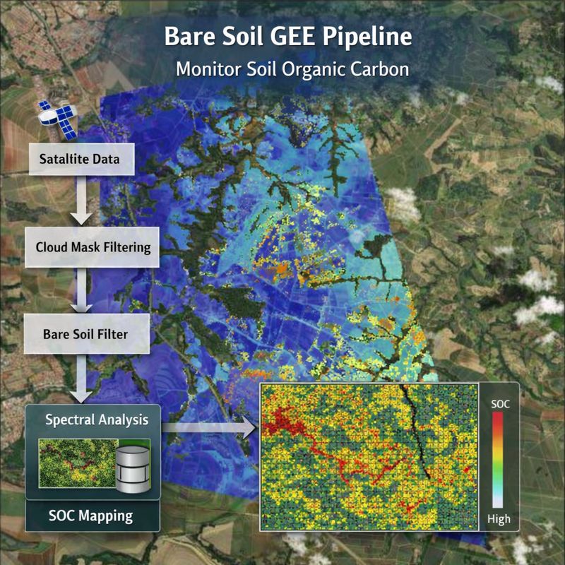
- Bare-soil composites, spectral indices, terrain, climate, and ancillary feature stacks
- Geospatial ML benchmarking for spatial prediction with appropriate baselines
- Validation design, uncertainty summaries, and error diagnostics suitable for technical reporting
- GIS-ready rasters/vectors, dashboard-ready outputs, reproducible code, and provenance notes