Case Study · Public reproducible portfolio / applied remote-sensing workflow
Coastal and Water Change Monitoring
Reproducible satellite workflows for coastal habitat screening, reservoir surface-water monitoring, and communication-ready environmental change outputs.
Problem
Environmental and water-system change is often visible in satellite records before it is organized into decision-ready evidence. Coastal wetlands, reservoirs, and water-stressed landscapes require workflows that separate persistent signals from seasonal, atmospheric, tidal, or sensor-related noise.
Role
Giannis developed and documented reproducible remote-sensing workflows using Google Earth Engine, Sentinel-2, Python post-processing, visual review structures, summary outputs, and communication-ready figures. The work demonstrates how satellite screening can support technical reporting, environmental communication, and early-stage monitoring design.
Data and Methods
- Sentinel-2 surface reflectance and annual or seasonal composites
- Google Earth Engine processing and reproducible public repositories
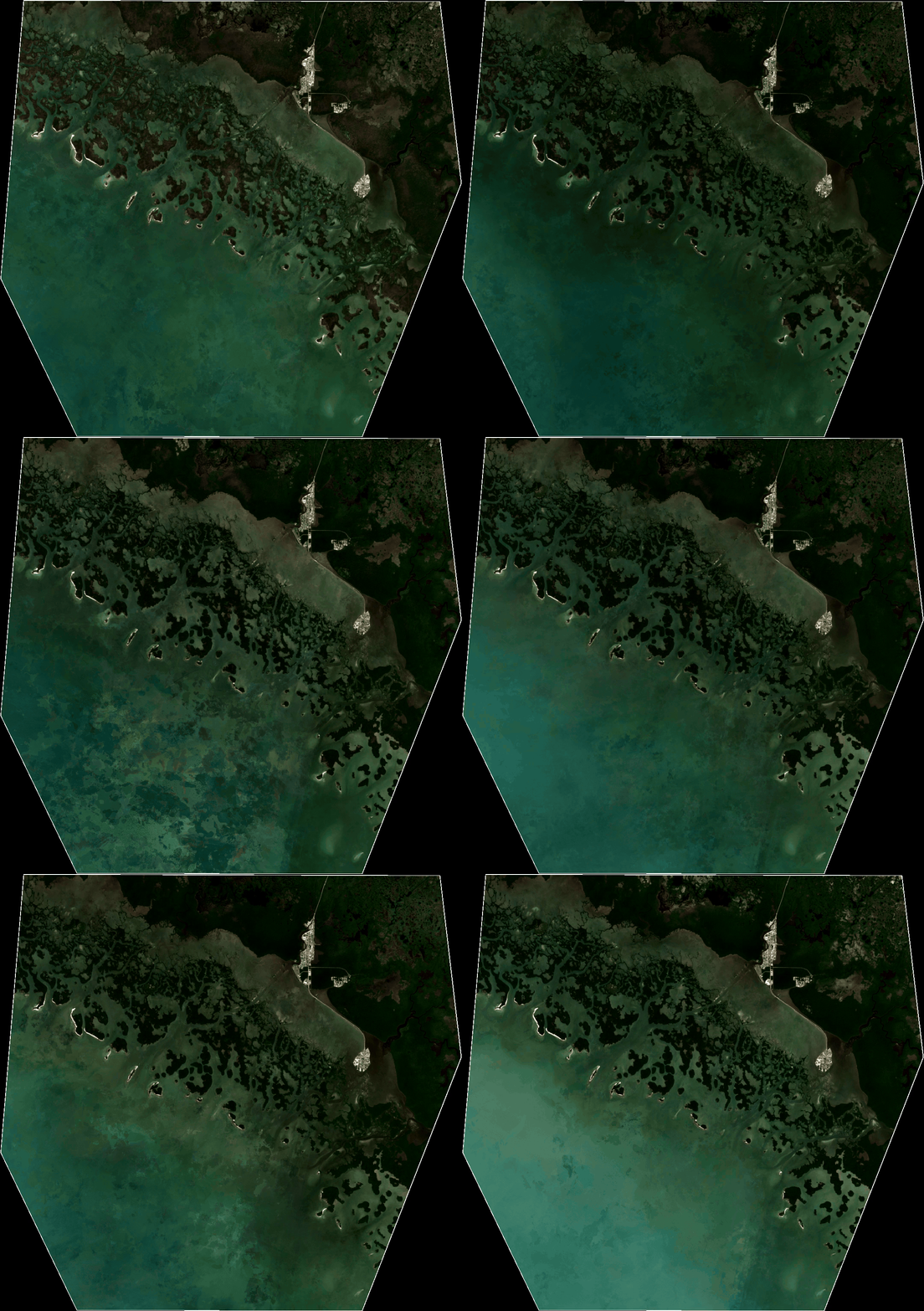
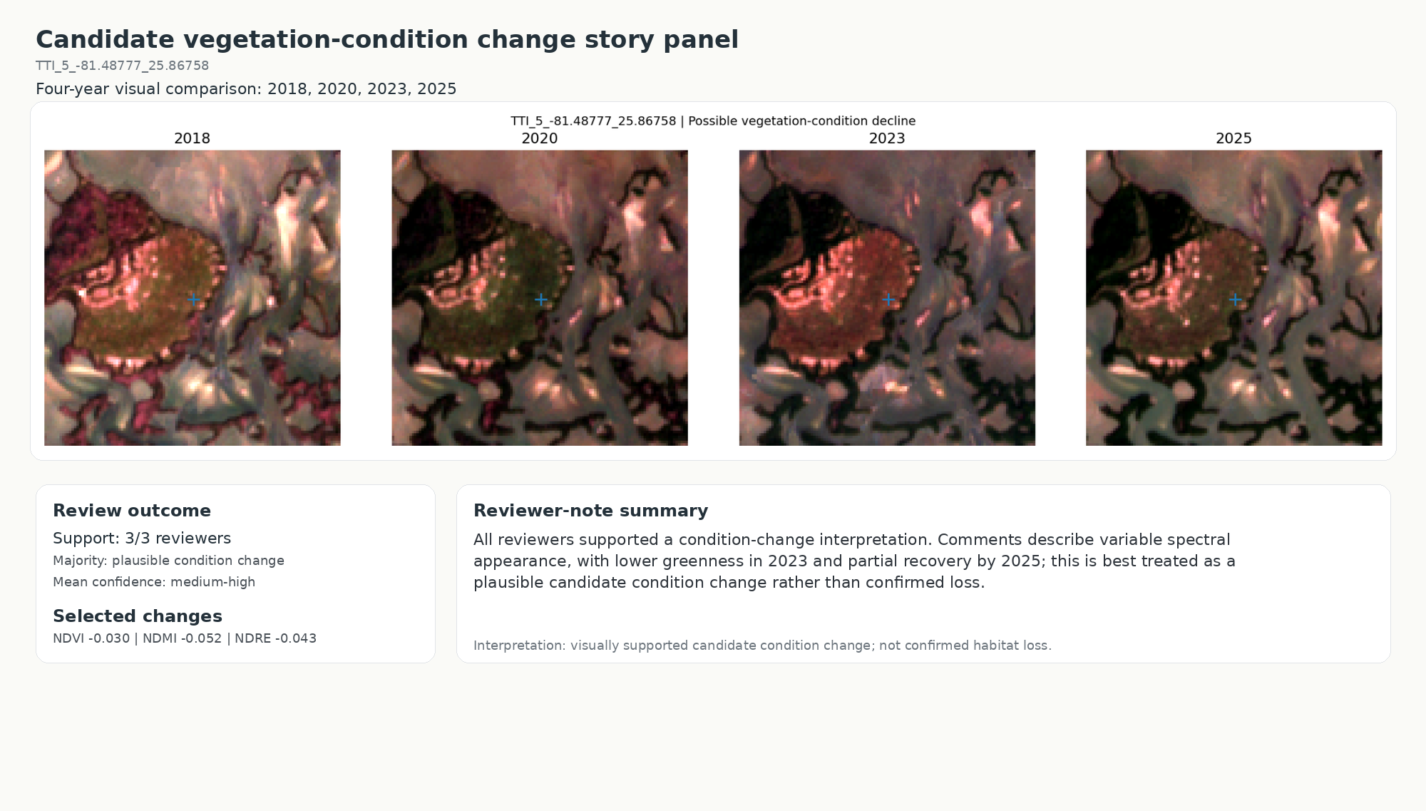
- Dynamic World support probabilities, conservative multi-year transition rules, and minimum-mapping-unit filtering for the Florida coastal project
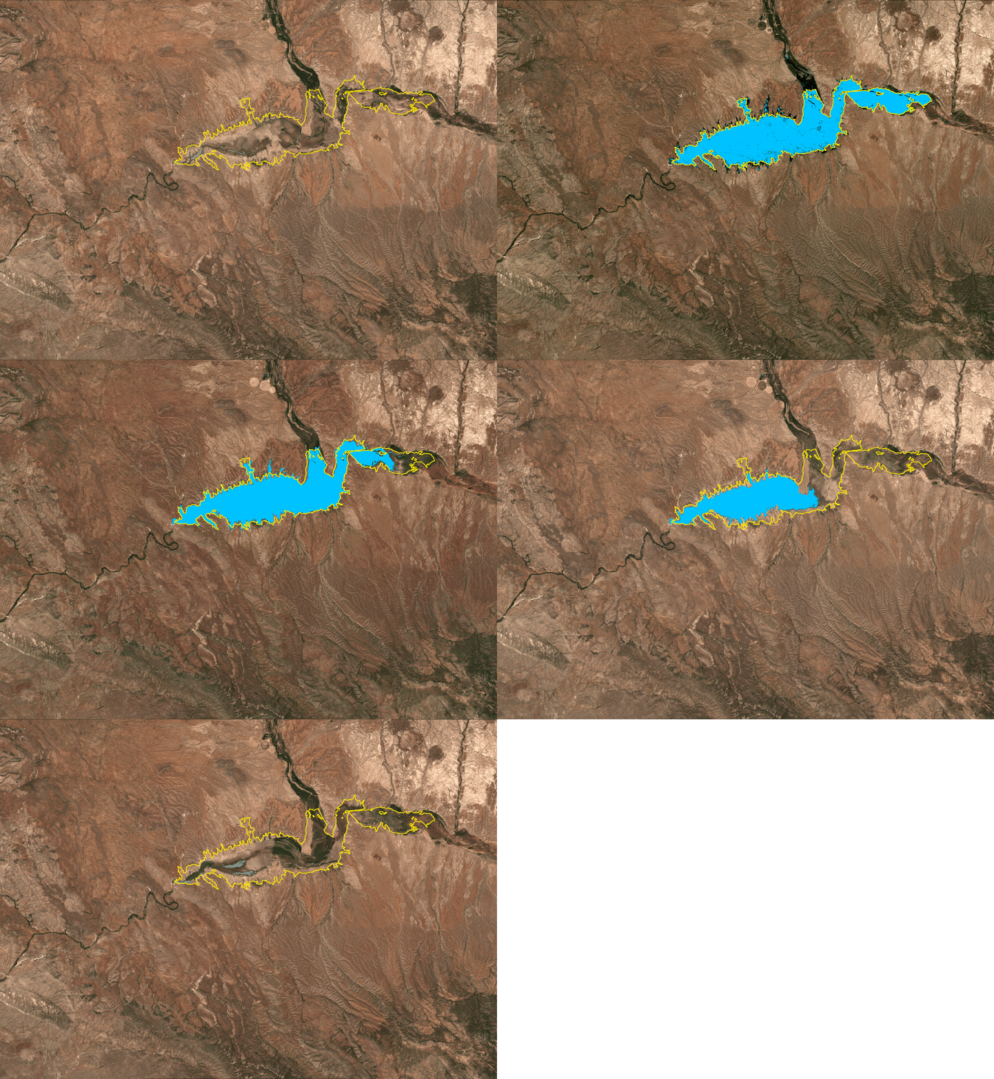
- A simple, transparent MNDWI and NDVI water mask for San Carlos Reservoir
- Python post-processing, summary outputs, conservative filtering, and structured visual review
Deliverables
- Google Earth Engine scripts and a Python post-processing workflow
- Visual dashboards, publication-ready figures, and communication outputs
- Timelapse GIF and MP4 products with labeled yearly frames
- CSV summaries, GeoJSON boundaries, and validation or review tables
- Public GitHub documentation and reproducible workflow guidance
Evidence and Status
Public reproducible portfolio / applied remote-sensing workflow. In the Ten Thousand Islands, the 2018–2025 workflow mapped approximately 37,053 ha: about 65.6% persistent water, 26.5% persistent coastal vegetation, 7.3% uncertain or inconsistent, and 0.5% developed or excluded. Conservative filtering retained approximately 40.9 ha (0.11%) as possible vegetation-condition decline—a candidate condition-change signal, not confirmed habitat loss. Three reviewers completed 90 decisions across 30 validation locations. At San Carlos Reservoir, detected surface-water area—not reservoir storage volume—peaked in the 2023 May–June composite and was 97.7% lower in 2026.
Institutional Relevance
These workflows are relevant to coastal monitoring, wetland and mangrove screening, water-resource communication, drought and reservoir monitoring, EO validation planning, environmental reporting, proposal-ready evidence, and early-stage MRV or monitoring-system design.
Limits and Next Steps
The coastal workflow is not a definitive habitat-loss assessment, and the reservoir workflow does not estimate storage volume or provide a full hydrologic attribution model. Tides, turbidity, sunglint, seasonal differences, atmospheric effects, water level, composite choices, and management context can affect interpretation. The San Carlos work is a remote-sensing communication product, not a full hydrologic attribution. Formal operational use would require additional calibration, local expert review, and hydrologic or field evidence appropriate to the decision.